South Platte River Planning + Needs Assessment
Location: Denver and Adams County, CO
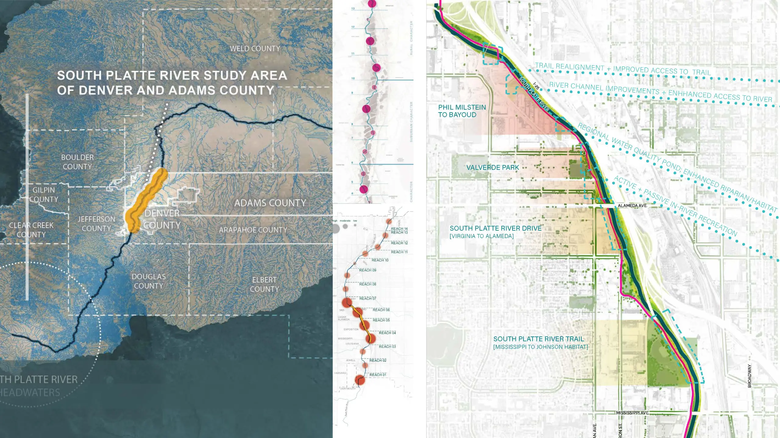
The South Platte River’s 30 miles through Denver and Adams County have been observed, examined, poked, and prodded all to understand one thing… What do the river – and the communities along it – need? These two agencies, tied together through the Mile High Flood District (MHFD), have created comprehensive assessment efforts to understand the answer to that question. As our team looked beyond hydrology and hydraulics as the primary consideration of waterways to encompass the other building blocks of geomorphology, vegetation, community values, and recreation, a holistic approach became the guiding force of these needs assessments.
What is equally special however, is that Denver’s South Platte River Corridor Needs Assessment, and Adams County’s Experience Your South Platte Needs Assessment speak to each other. By bridging this gap of technical information and these jurisdictions, a riverine transformation is dawning upon this area of the front range. The result is a network of data that is being used as the backbone for decision making, resource allocation, and project prioritization. Stream LA+P led this effort with a team of with technical consultants and key stakeholders, ultimately completing a quantitative and qualitative analysis, bringing data for the entire reach into one cohesive map-based tool. In order to develop a holistic evaluation framework, the assessments use a “river-centric” lens to identify gaps between existing and desired conditions of the corridor, facilitating the prioritization of future investment and project planning of the corridor.
Informed by stakeholder and community outreach, the assessments illustrate specific ‘levels of need’ for river corridor improvements, natural systems, equitable high-quality human experiences, and mobility enhancements that create better community connections and access to nature and the river. Three key objectives of River Health, Human Experience, and Connected Mobility were assessed equally through identification, mapping, and evaluation of issues. Using this data, the team developed easily accessible interactive online resources including web-based GIS mapping and a user-friendly StoryMap website. The assessments are the foundation for identifying and planning for transformational projects throughout the highest need areas along the corridor.
Special Factors:
- The project is a catalyst for garnering investment and resources and allocating these assets based on a consistent set of criteria and to areas for which they will be most impactful.
- The nature of the data within the project’s map-based products is fluid as the corridor is constantly evolving. Data can be updated in ‘real-time’ allowing the assessment to evolve with improvements and accommodate information updates to reduce discrepancies and provide consistently reliable information.
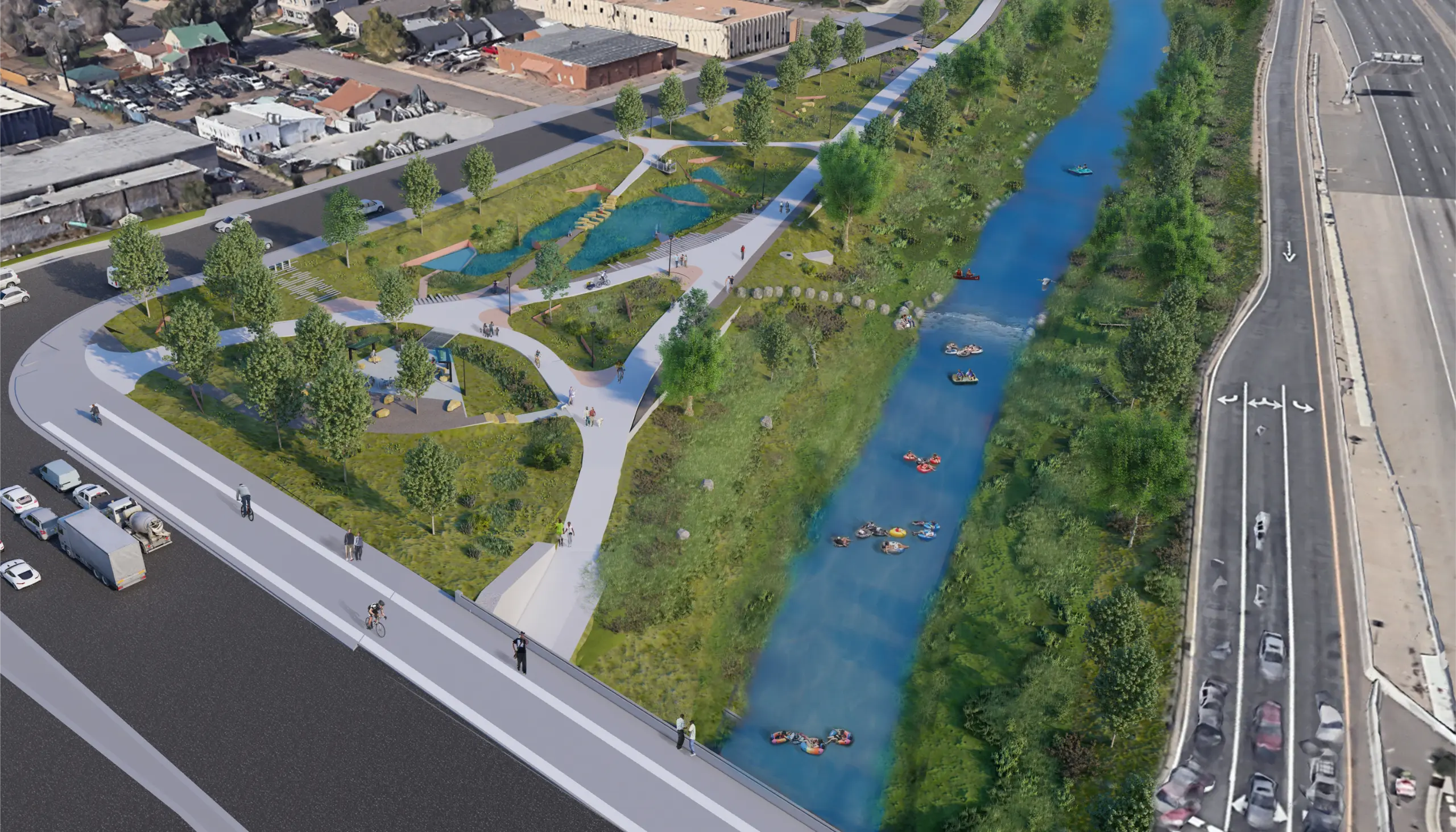
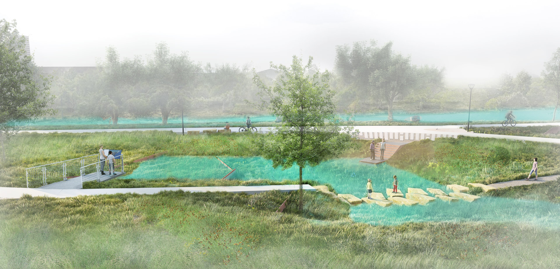
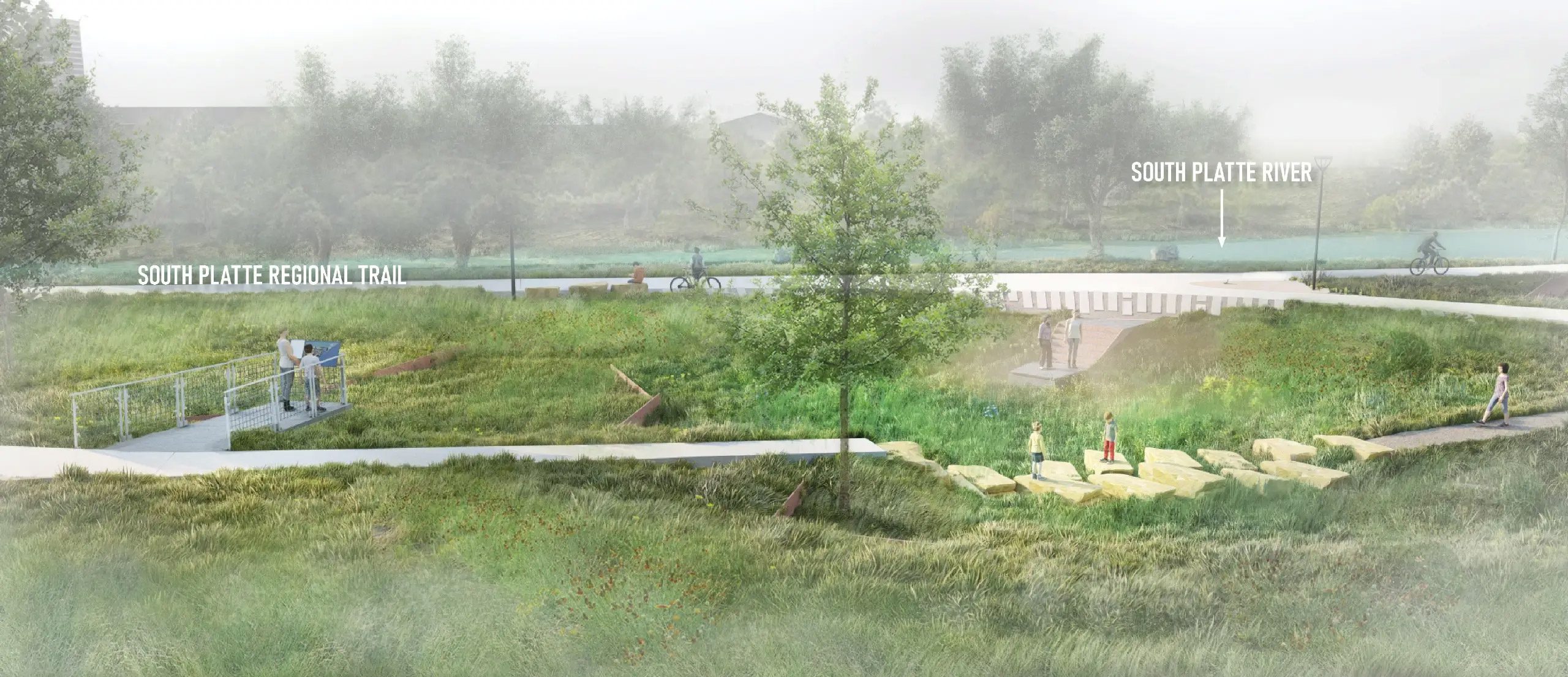
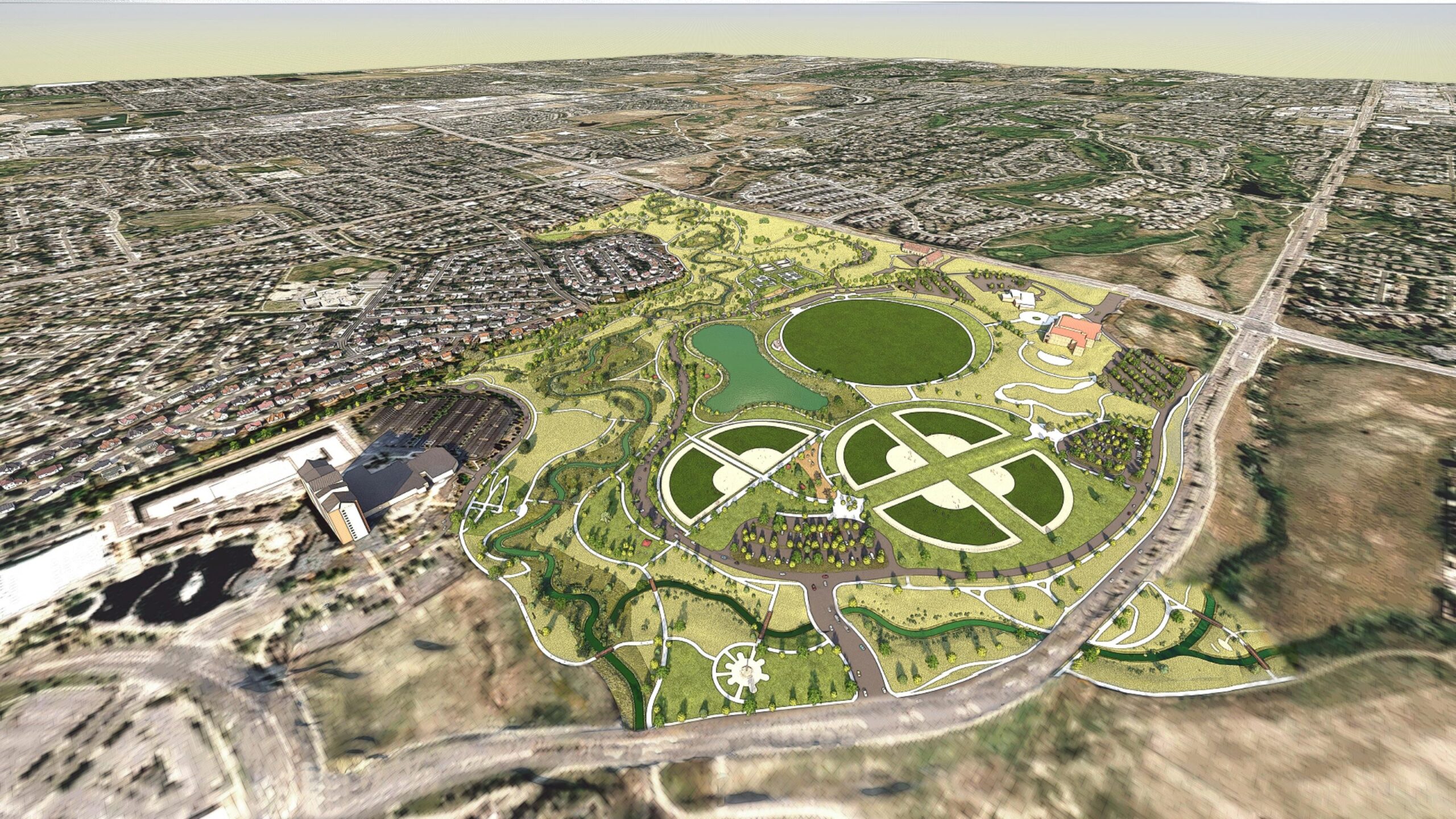
South Platte River Trail, Open Space + Floodway Improvements
Stream is currently working to finalize construction documents on various portions of the South Platte River corridor for more than $15m in improvements, including the following projects:
- Riverdale Bluffs Open Space and Regional Trails (Adams)
- Lipan Open Space, Trail-head, and Water Quality area (Denver)
- South Platte River Dr. Improvements and Regional Trail – Virgina to Alameda (Denver)
- South Platte River Trail (Mississippi to Johnson Habitat) (Denver)
Clients & Recognition
View All AwardsPanorama Park
2023 Merit Award for Design
With special recognition for exemplary diversity, equity, and inclusion efforts
Colorado American Society of Landscape Architects (ASLA)
Colorado Springs, Colorado